GPS Data GPS/Cell Tower Data
obtained from iPhone and
mapped on Google Earth
SIM v MicroSD Difference bewteen
a SIM and MicroSD Cards.
Picture retrieved
from an iPhone Picture contains GPs
coordinates and other
valuable information
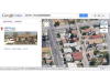
Picture viewed in
Goolge Moas
You can click on the GPS
link and view the picture
in Google Maps and see
exactly where it was taken.
Retrieved Call Log Sanoke call iog
with deleted items
recovered
Cell Tower/Wi-Fi Cell Towers and Wi-Fi
locations can be mapped
on Google Earth
Cell Tower/RF Data Cell Tower and RF
Data can be plootted
on a map to show
the coverage area
Typical Cell Tower Sector Each sector on a
cell tower covers
approximately 120 degrees
Cell Call Plotted on Map Calls can be plotted on a
map to view the area covered
by a particlar cell tower and setor

)
)
)
)
)
)
)
)
)